Stone Axes and Aboriginal Stories from Victoria

Yarra River
Yarra River. Photo Nick Carson.

In the most recent edition of Australian Archaeology, the journal of the Australian Archaeological Association, there is a paper examining the exchange of stone axes in Victoria and correlating these patterns of exchange with Aboriginal stories in the 19th century. This paper is particularly timely with the passing of legislation in the Victorian Parliament on 21 September 2017, concerning management of the Yarra River. This legislation, the first in Victorian state legislation to include phrases in an indigenous language (Woi-wurrung, the language of the Wurundjeri people – custodians of the Yarra River) recognises the connections between the river and local indigenous people. The Act contains a strategic plan for the river’s management and protection, and provides for a council (the Birrarung – a local indigenous name for the Yarra River – Council), which must include at least 2 traditional owners, to advise and advocate for the river.
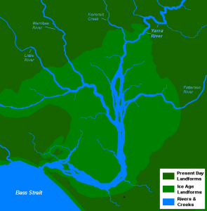
Port Phillip 10000 yrs ago
Port Phillip during the Ice Age

The Yarra River runs south-west from the Australian Alps and enters Port Phillip Bay in the city of Melbourne. During the Ice Age, when global sea levels were lower, the river drained directly into Bass Strait (see image to right). Port Phillip bay was flooded by rising sea levels at the end of the Ice Age, reaching its present extent about 8,000 years ago. The bay was briefly drained when the entrance was blocked by a sand bar between 800 and 1,000 CE (about 1,000 years ago). Aboriginal stories recall this well: in 1846, the colonial magistrate, William Hull recorded that local Aboriginal people told him that they:

recollected when Hobson’s Bay [Port Phillip Bay] was a kangaroo ground; they say, “Plenty catch kangaroo, and plenty catch opossum there;” and [an informant] assured me that the passage up the bay, through which the ships came, is the River Yarra, and that river once went out at the heads, but that the sea broke in, and that Hobson’s Bay, which was once hunting ground, became what it is

This detailed knowledge of the now submerged area shows the depth of Aboriginal oral traditions, passed down in stories and lore, as part of their ongoing management of the Australian landscape. Many of these stories had intricate myths, which nevertheless included information on how to manage the environment. It appears that the exchange of axes, initially of stone, and later of iron, was part of these stories. The best raw material for making stone axes (and thus the best stone axes) came from the stone quarry at Mount William, near Lancefield about 78 km north of Melbourne. The local Wurundjeri people made very fine greenstone axes, which were traded over huge distances, some as far as 1,000 km, in the period before Europeans arrived in Australia.

William Buckley
William Buckley

In 1803, the British tried to start a convict settlement on Port Phillip Bay, near modern Sorrento, but within a few months the convicts were moved to Tasmania when a lack of water and conflict with local Aboriginal groups made the settlement unviable. During the upheavals, some convicts escaped, one of whom was William Buckley, who then lived with local Aboriginal people, the Wadawurrung, for the next 32 years. After Melbourne was settled and Buckley had rejoined European society, he worked as a translator for the missionary George Langhorne, who wrote down some of Buckley’s stories. One of these mentioned axes (or “tomahawks”):

There are… two imaginary Beings whom [the Wadawurrung] treat with a certain degree of respect. One of these is supposed to reside in a certain marsh and to be the author of all the Songs which he makes known to them through his Sons. The other is supposed to have charge of the Pole or Pillar by which the Sky is propped. Just before the Europeans came to Port Phillip this personage was the subject of general conversation it was reported among them that he had sent a message to the Tribes to send a certain number of Tomahawks to enable him to prepare a new prop for the Sky as the other had become rotten and their destruction was inevitable should the sky fall on them to prevent this and to supply as great a number of iron Tomahawks as possible

Very similar stories are repeated in a range of sources, including the records of A.W. Howitt, a 19th century anthropologist, who interviewed William Barak, a senior clan head of the Woiwurrung, who had been about 11 years old (and a witness to events) when John Batman signed his treaty with clan leaders. Barak’s uncle was custodian of the Mount William stone axe quarry, a title which Barak later inherited. Howitt recorded:

They believed too that the sky was propped up by poles where it rested on the mountains in the north-east. Before the “white men came to Melbourne” a message was passed from tribe to tribe, until it reached the Wurunjerri, that the props were becoming rotten, and that unless tomahawks were at once sent up to cut new ones, the sky would fall and burst, and all the people would be drowned

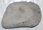
Aboriginal stone axe
Aboriginal ground stone axe

A similar story was recorded by Ethel Shaw, the daughter of the station manager at Yelta Station (also a mission) on the Murray River, about 500km north-west of Melbourne, home of the Marawara people, as having been told to her father in the late 19th century. These stories were linked to the flood stories, which are very common in Aboriginal traditions, and relate in great detail which areas were flooded. Various mythological reasons are given for these inundations, including that the sky fell, causing the clouds to burst open when they hit the ground and release all the rainwater in huge floods.

Stories also record the efforts of ancestors to manage the water flow down from the mountains, by cutting channels for water to flow – an activity which is described as “using up too many stone axes”. As custodians of the land, each Aboriginal group had responsibilities related to managing the environment and trying to ensure that it remained healthy and stable. It appears that the need for stone axes in the mountains, some distance from the Mount William quarry, was articulated in stories, which ensured that stone axes were supplied to the mountains, thus helping maintain exchange networks over long distances and ensuring equitable access to resources.

We now know that ground stone axes date back 65,000 years to the earliest evidence of Aboriginal settlement in Australia. Over the millennia, especially following the huge climate changes at the end of the Ice Age, Aboriginal people developed ways of managing the environment and exchanging resources. The framework for these activities was a rich tradition of stories and mythology, which helped people to relate to their world and their role within it. We are still learning to interpret all the information within these stories.

New Dates for Earliest Archaeological Site in Aus!

Thylacine or Tasmanian Tiger.

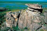
This morning news was released of a date of 65,000 years for archaeological material at the site of Madjedbebe rock shelter in the Jabiluka mineral lease area, surrounded by Kakadu National Park. The site is on the land of the Mirarr people, who have partnered with archaeologists from the University of Queensland for this investigation. It has also produced evidence of the earliest use of ground-stone tool technology, the oldest seed-grinding tools in Australia and stone points, which may have been used as spears. Most fascinating of all, there is the jawbone of a Tasmanian Tiger or Thylacine (which was found across continental Australia during the Ice Age) coated in a red pigment, thought to be the reddish rock, ochre. There is much evidence of use of ochre at the site, with chucks and ground ochre found throughout the site. Ochre is often used for rock art and the area has much beautiful rock art, so we can deduce that these rock art traditions are as old as the occupation of people in Australia, i.e. at least 65,000 years old! The decoration of the jawbone hints at a complex realm of abstract thought, and possibly belief, amongst our distant ancestors – the direct forebears of modern Aboriginal people.

Kakadu view, NT Tourism.

Placing the finds from Madjebebe rock shelter within the larger context, the dating, undertaken by Professor Zenobia Jacobs from the University of Wollongong, shows that people were living at the site during the Ice Age, a time when many, now-extinct, giant animals roamed Australia; and the tiny Homo floresiensis was living in Indonesia. These finds show that the ancestors of Aboriginal people came to Australia with much of the toolkit of their rich, complex lives already in place. This technology, extremely advanced for the time, allowed them to populate the entire continent of Australia, first managing to survive in the hash Ice Age environment and then also managing to adapt to the enormous changes in sea level, climate and vegetation at the end of the Ice Age.

The team of archaeologists working at Madjebebe rock shelter, in conjunction with Mirarr traditional owners, are finding all sorts of wonderful archaeological material, from which they can deduce much rich, detailed information about the lives of the earliest people in Australia. We look forward to hearing more from them in the future. Students who are interested, especially those in Years 4, 5 and 6, can read more about these sites and the animals and lives of people in Ice Age Australia in our resources People Reach Australia, Early Australian Sites, Ice Age Animals and the Last Ice Age, which are covered in Units 4.1, 5.1 and 6.1.

This Week in HASS – term 2, week 1

Welcome to the new school term, and we hope you all had a wonderful Easter! Many of our students are writing NAPLAN this term, so the HASS program provides a refreshing focus on something different, whilst practising skills that will help students prepare for NAPLAN without even realising it! Both literacy and numeracy are foundation skills of much of the broader curriculum and are reinforced within our HASS program as well. Meantime our younger students are focusing on local landscapes this term, while our older students are studying explorers of different continents.

Foundation to Year 3

Our youngest students (Foundation/Prep Unit F.2) start the term by looking at different types of homes. A wide selection of places can be homes for people around the world, so students can compare where they live to other types of homes. Students in integrated Foundation/Prep and Years 1 to 3 (Units F.61.2; 2.2 and 3.2) start their examination of the local landscape by examining how Aboriginal people arrived in Australia 60,000 years ago. They learn how modern humans expanded across the world during the last Ice Age, reaching Australia via South-East Asia. Starting with this broad focus allows them to narrow down in later weeks, finally focusing on their local community.

Year 3 to Year 6

Students in Years 3 to 6 (Units 3.6; 4.2; 5.2 and 6.2) are looking at explorers this term. Each year level focuses on explorers of a different part of the world. Year 3 students investigate different climate zones and explorers of extreme climate areas (such as the Poles, or the Central Deserts of Australia).  Year 4 students examine Africa and South America and investigate how European explorers during the ‘Age of Discovery‘ encountered different environments, animals and people on these continents. The students start with prehistory and this week they are looking at how Ancient Egyptians and Bantu-speaking groups explored Africa thousands of years ago. They also examine Great Zimbabwe. Year 5 students are studying North America, and this week are starting with the Viking voyages to Greenland and Newfoundland, in the 10th century. Year 6 students focus on Asia, and start with a study in Economics by examining the Dutch East India Company of the 17th and 18th centuries. (Remember HASS for years 5 and 6 includes History, Geography, Civics and Citizenship and Economics and Business – we cover it all, plus Science!)

You might be wondering how on earth we integrate such apparently disparate topics for multi-year classes! Well, our Teacher Handbooks are full of tricks to make teaching these integrated classes a breeze. The Teacher Handbooks with lesson plans and hints for how to integrate across year levels are included, along with the Student Workbooks, Model Answers and Assessment Guides, within our bundles for each unit. Teachers using these units have been thrilled at how easy it is to use our material in multi-year level classes, whilst knowing that each student is covering curriculum-appropriate material for their own year level.

Am I a Neanderthal?

Early reconstruction of Neanderthal

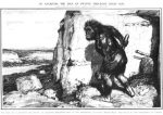
The whole question of how Neanderthals are related to us (modern humans) has been controversial ever since the first Neanderthal bones were found in Germany in the 19th century. Belonging to an elderly, arthritic individual (a good example of how well Neanderthals cared for each other in social groups), the bones were reconstructed to show a stooping individual, with a more ape-like gait, leading to Neanderthals being described as the “Missing Link” between apes and humans, and given the epithet “ape-man”.

Who were the Neanderthals?

Modern reconstruction – Smithsonian Museum of Natural History

Neanderthals lived in the lands surrounding the Mediterranean Sea, and as far east as the Altai Mountains in Central Asia, between about 250,000 and about 30,000 years ago. They were a form of ancient human with certain physical characteristics – many of which probably helped them cope with the cold of Ice Ages. Neanderthals evolved out of an earlier ancestorHomo erectus, possibly through another species – Homo heidelbergensis. They had a larger brain than modern humans, but it was shaped slightly differently, with less development in the prefrontal cortex, which allows critical thinking and problem-solving, and larger development at the back of the skull, and in areas associated with memory in our brains. It is possible that Neanderthals had excellent memory, but poor analytical skills. They were probably not good at innovation – a skill which became vital as the Ice Age ended and the global climate warmed, sea levels rose and plant and animal habitats changed.

Neanderthals were stockier than modern humans, with shorter arms and legs, and probably stronger and all-round tougher. They had a larger rib cage, and probably bigger lungs, a bigger nose, larger eyes and little to no chin. Most of these adaptations would have helped them in Ice Age Europe and Asia – a more compact body stayed warmer more easily and was tough enough to cope with a harsh environment. Large lungs helped oxygenate the blood and there is evidence that they had more blood supply to the face – so probably had warm, ruddy cheeks. The large nose warmed up the air they breathed, before it reached their lungs, reducing the likelihood of contracting pneumonia. Neanderthals are known to have had the same range of hair colours as modern humans and fair skin, red hair and freckles may have been more common.

They made stone tools, especially those of the type called Mousterian, constructed simple dwellings and boats, made and used fire, including for cooking their food, and looked after each other in social groups. Evidence of skeletons with extensive injuries occurring well before death, shows that these individuals must have been cared for, not only whilst recovering from their injuries, but also afterwards, when they would probably not have been able to obtain food themselves. Whether or not Neanderthals intentionally buried their dead is an area of hot controversy. It was once thought that they buried their dead with flowers in the grave, but the pollen was found to have been introduced accidentally. However, claims of intentional burial are still debated from other sites.

What Happened to the Neanderthals?

Abrigo do Lagar Velho

Anatomically modern humans emerged from Africa about 100,000 years ago. Recent studies of human genetics suggests that modern humans had many episodes of mixing with various lineages of human ancestors around the planet. Modern humans moved into Asia and Europe during the Ice Age, expanding further as the Ice Age ended. Modern humans overlapped with Neanderthals for about 60,000 years, before the Neanderthals disappeared. It is thought that a combination of factors led to the decline of Neanderthals. Firstly, the arrival of modern humans, followed by the end of the Ice Age, brought about a series of challenges which Neanderthals might have been unable to adapt to, as quickly as necessary. Modern humans have more problem solving and innovation capability, which might have meant that they were able to out-compete Neanderthals in a changing environment. The longest held theory is that out ancestors wiped out the Neanderthals in the first genocide in (pre)history. A find of Neanderthals in a group, across a range of ages, some from the same family group, who all died at the same time, is one of the sites, which might support this theory, although we don’t actually know who (or what) killed the group. Cut marks on their bones show that they were killed by something using stone tools. Finally, there is more and more evidence of what are called “transitional specimens”. These are individuals who have physical characteristics of both groups, and must represent inter-breeding. An example is the 4 year old child from the site of Abrigo do Lagar Velho in Portugal, which seems to have a combination of modern and Neanderthal features. The discovery of Neanderthals genes in many modern people living today is also proof that we must have interbred with Neanderthals in the past. It is thought that the genes were mixed several times, in several parts of the world.

Am I a Neanderthal?

So how do we know if we have Neanderthals genes? Neanderthal genes have some physical characteristics, but also other attributes that we can’t see. In terms of physical characteristics, Neanderthal aspects to the skull include brow ridges (ridges of bone above the eyes, under the eyebrows); a bump on the back of the head – called an occipital chignon, or bun, because it looks like a ‘bun’ hairstyle, built into the bone; a long skull (like Captain Jean-Lu Picard from Star Trek – actor Patrick Stewart); a small, or non-existent chin; a large nose; a large jaw with lots of space for wisdom teeth; wide fingers and thumbs; thick, straight hair; large eyes; red hair, fair skin and freckles! The last may seem a little surprising, but it appears that the genes for these characteristics came from Neanderthals – who had a wide range of hair colours, fair skin and, occasionally, freckles. Increased blood flow to the face also would have given Neanderthals lovely rosy cheeks!

Less obvious characteristics include resistance to certain diseases – parts of our immune systems, especially with reference to European and Asian diseases; less positively, an increased risk of other diseases, such as type 2 diabetes. Certain genes linked to depression are present, but ‘switched off’ in Neanderthals. The way that these genes link to depression, and their role in the lifestyles of early people (where they may have had benefits that are no longer relevant) are future topics for research and may help us understand more about ourselves.

Neanderthals genes are present in modern populations from Europe, Asia, Northern Africa, Australia and Oceania. So, depending on which parts of the world our ancestry is from, we may have up to 4% of our genetics from long-dead Neanderthal ancestors!

This Week in HASS – term 1, week 3

This is a global week in HASS for primary students. Our youngest students are marking countries around the world where they have family members, slightly older students are examining the Mayan calendar, while older students get nearer to Australia, examining how people reached Australia and encountered its unique wildlife.

Foundation to Year 3

Mayan date

Foundation students doing the Me and My Global Family unit (F.1) are working with the world map this week, marking countries where they have family members with coloured sticky dots. Those doing the My Global Family unit (F.6), and students in Years 1 to 3 (Units 1.1; 2.1 and 3.1), are examining the Mayan calendar this week. The Mayan calendar is a good example of an alternative type of calendar, because it is made up of different parts, some of which do not track the seasons, and is cyclical, based on nested circles. The students learn about the 2 main calendars used by the Mayans – a secular and a celebratory sacred calendar, as well as how the Mayans divided time into circles running at different scales – from the day to the millennium and beyond. And no, in case anyone is still wondering – they did not predict the end of the world in 2012, merely the end of one particular long-range cycle, and hence, the beginning of a new one…

Years 3 to 6

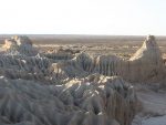
Lake Mungo, where people lived at least 40,000 years ago.

Students doing the Exploring Climates unit (3.6), and those in Years 4 to 6 (Units 4.1, 5.1 and 6.1), are examining how people reached Australia during the Ice Age, and what Australia was like when they arrived. People had to cross at least 90 km of open sea to reach Australia, even during the height of the Ice Age, and this sea gap led to the relative isolation of animals in Australia from others in Asia. This phenomenon was first recorded by Alfred Wallace, who drew a line on a map marking the change in fauna. This line became known as the Wallace line, as a result. Students will also examine the archaeological evidence, and sites of the first people in Australia, ancestors of Aboriginal people. The range of sites across Australia, with increasingly early dates, amply demonstrate the depth of antiquity of Aboriginal knowledge and experience in Australia.

This Week in HASS: term 1 week 2

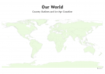
OpenSTEM A0 world map: Country Outlines and Ice Age CoastlineFoundation to Year 3

Our standalone Foundation (Prep/Kindy etc) students are introduced to the World Map this week, as they start putting stickers on it, showing where in the world they and their families come from – the origin of the title of this unit (Me and My Global Family). This helps students to feel connected with each other and to start to understand both the notion of the ‘global family’, as well as the idea that places can be represented by pictures (maps). Of course, we don’t expect most 5 year olds to understand the world map, but the sooner they start working with it, the deeper the familiarity and understanding later on.

Year 1-3 Building Stonehenge Activity - OpenSTEM History/Geography program for Primary Schools
Students building Stonehenge with blocks

All the other younger students are learning about movements of celestial bodies (the Earth and Moon, as they go around the Sun and each other) and that people have measured time in the past with reference to both the Sun and the Moon – Solar and Lunar calendars. To make these ideas more concrete, students study ancient calendars, such as Stonehenge, Newgrange and Abu Simbel, and take part in an activity building a model of Stonehenge from boxes or blocks.

Years 3 to 6

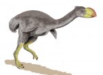
Demon Duck of Doom

Our older primary students are going back into the Ice Age (and who wouldn’t want to, in this weather!), as they explore the routes of modern humans leaving Africa, as part of understanding how people reached Australia. Aboriginal people arrived in Australia as part of the waves of modern humans spreading across the world. However, the Australia they encountered was very different from today. It was cold, dry and very dusty, inhabited by giant Ice Age animals (the Demon Duck of Doom is always a hot favourite with the students!) and overall, a pretty dangerous place. We challenge students to imagine life in those times, and thereby start to understand the basis for some of the Dreamtime stories, as well as the long and intricate relationship between Aboriginal people and the Australian environment.